Oregon Natural Wonders: Crater Lake to Thor’s Well, With a Map Table
Lakes, waterfalls, painted desert and sea stacks, grouped by region with drive times, passes and a week-long loop to see them.
Oregon’s natural wonders include Crater Lake, the deepest lake in the United States at 1,943 feet; the striped Painted Hills; the cliffs of Smith Rock; Multnomah Falls, which drops 620 feet in the Columbia River Gorge; Toketee Falls on the North Umpqua River; and the coast’s sea stacks and Thor’s Well. Most are 30 minutes to 5 hours from Portland, and several need a permit or parking pass as of November 2026.
The state splits into three very different regions: the wet Coast, the Cascades with their lakes and waterfalls, and the dry high desert east of the mountains. The table below works as a map: pick the stops in one region per day.
Where are Oregon’s natural wonders, and how far are they from Portland?
| Wonder | Region | Nearest town | Drive from Portland | Best months | Fee or permit (as of Nov 2026) |
|---|---|---|---|---|---|
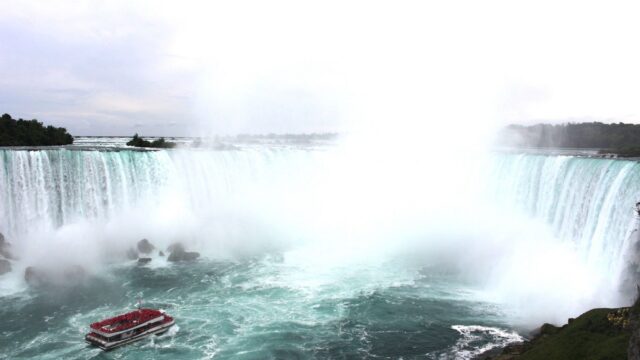
| Multnomah Falls | Columbia River Gorge | Troutdale | About 40 minutes | Year-round; strongest flow in winter and spring | $2 timed-use permit for the I-84 lot in summer |
| Haystack Rock | North Coast | Cannon Beach | About 1.5 hours | Low tides; puffins in spring and summer | None for the beach |
| Thor’s Well | Central Coast | Yachats | About 3 hours | Year-round, near high tide | Forest Service day-use pass at some lots |
| Smith Rock | Central Oregon | Terrebonne / Redmond | About 3 hours | Spring and fall | $10–$12.50 state park day-use parking |
| Painted Hills | High desert | Mitchell | About 4 hours | Spring and fall; colors deepen after rain | No entrance fee |
| Bandon sea stacks, including Face Rock and Elephant Rock | South Coast | Bandon | About 4.5 hours | Year-round; low tide for beach walks | None at most viewpoints |
| Toketee Falls | Southern Cascades | Roseburg | About 4 hours | Late spring to fall | Check the Umpqua National Forest page |
| Crater Lake | Southern Cascades | Klamath Falls / Medford | About 4.5–5 hours | July to early October for full access | $30 per vehicle in summer, $20 in winter |
Drive times are estimates without traffic or stops.
What should you know before visiting Crater Lake?
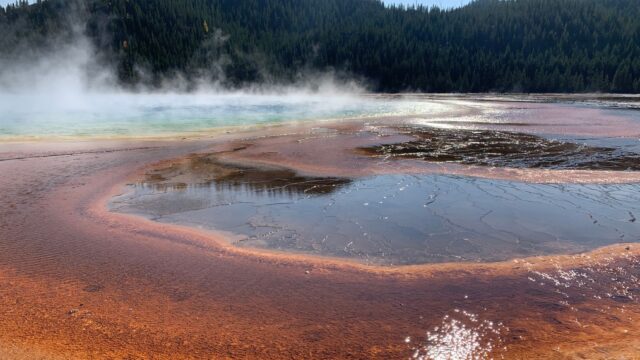
Crater Lake National Park is open year-round, but the 33-mile Rim Drive is only fully open in summer, usually from about July into October, and was closed for the 2026–27 winter as of early November. Munson Valley Road to Rim Village stays open in winter, weather permitting.
- Fees: $30 per vehicle from May 22 to October 31 and $20 from November 1 to May 21, as of November 2026.
- No lake access for now: the Cleetwood Cove Trail, the only trail down to the water, is closed for a major construction project and is expected to stay closed until 2029.
- Winter: heavy snow closes the North Entrance and Rim Drive; snowshoe walks and views from Rim Village remain.
- Summer: drive Rim Drive clockwise or counterclockwise with stops at Watchman Overlook, Phantom Ship Overlook and Cloudcap.
Check the park’s current conditions page for road status before you go.
Do you need a permit for Multnomah Falls?
In summer, yes, if you park at the I-84 Exit 31 lot. In 2026, a Multnomah Falls Timed Use Permit was required daily from 9 a.m. to 6 p.m. between May 22 and September 7; the rest of the year no permit is needed.
- Book online on Recreation.gov or its app; permits are not sold on site.
- Book 14 days ahead at 7 a.m. Pacific, on a rolling daily window.
- Pay $2 per vehicle as a transaction fee; each permit covers a one-hour arrival slot.
- Exceptions: visitors arriving by bike did not need a permit, and the Historic Columbia River Highway (US-30) had no permit requirement in 2026.
A permit does not guarantee a parking space. Details for next summer will appear on the Recreation.gov Multnomah Falls permit page. The falls are one of the stops in our list of the best waterfalls in the US.
How do you visit the Painted Hills and Smith Rock?
Both are in the dry country east of the Cascades and pair well on a two-day trip from Bend.
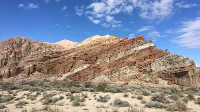
Painted Hills are one of three units of John Day Fossil Beds National Monument, near the small town of Mitchell. There is no entrance fee. Short trails include the Painted Hills Overlook Trail and the Painted Cove boardwalk, where the red and yellow clay is close at hand. Footprints stay in the clay for years, so walk only on trails and boardwalks. Colors look richest after rain and in soft morning or evening light.
Smith Rock State Park sits above a bend in the Crooked River, about 30 minutes north of Bend. Day-use parking costs $10 per vehicle for Oregon residents and $12–$12.50 for nonresidents as of November 2026; see Oregon State Parks parking permits. The Misery Ridge Trail climbs steeply to views of Monkey Face, a well-known rock climbing spire. Summer afternoons are hot and shadeless, so hike early.
Where is Toketee Falls, and how long is the walk?
Toketee Falls is in the Umpqua National Forest off Oregon Route 138, east of Roseburg. A 0.4-mile trail with nearly 200 steps leads to a viewing platform over a two-tier waterfall: a 40-foot upper drop and an 80-foot plunge over a wall of columnar basalt.
Stay on the platform. Scrambling down to the pool is dangerous on steep, unstable slopes. The falls fit on a scenic drive along the North Umpqua River, which has several other short waterfall walks, and the same highway continues to Crater Lake’s North Entrance in summer.
Which coast sea stacks and viewpoints are worth the drive?
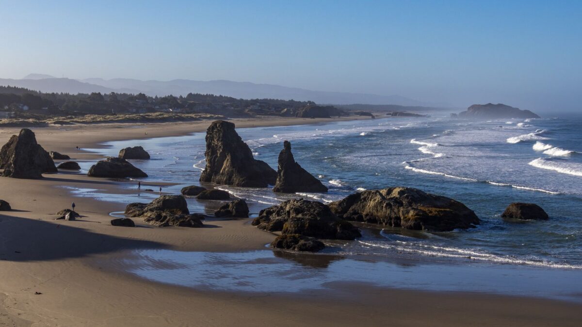
Haystack Rock at Cannon Beach is the best-known sea stack, rising about 235 feet from the beach, and the Bandon coast has one of the densest clusters of rocks, including Face Rock and Elephant Rock.
- Haystack Rock (Cannon Beach): tide pools at its base at low tide; tufted puffins nest on the rock in spring and summer.
- Bandon: viewpoints at Face Rock and Coquille Point look over dozens of rocks; beach walks are best at low tide.
- Thor’s Well (Cape Perpetua, near Yachats): a hole in the rock shelf that seems to drain the sea as waves surge in, best about an hour around high tide.
The offshore rocks are part of Oregon Islands National Wildlife Refuge and are closed to climbing to protect nesting seabirds and seals. At Thor’s Well and nearby Spouting Horn and Devil’s Churn, waves can surge over the rocks without warning; watch from a safe distance and never turn your back on the ocean.
How do you plan an Oregon natural wonders road trip?
A loop of 6–8 days covers the highlights without long backtracking.
- Day 1: Portland to the Columbia River Gorge and Multnomah Falls.
- Day 2: Gorge to Bend via Mount Hood; evening at Smith Rock.
- Day 3: Day trip from Bend to the Painted Hills.
- Day 4: Bend to Crater Lake (summer), overnight nearby.
- Day 5: North Umpqua waterfalls including Toketee, then to the coast.
- Day 6: Bandon sea stacks, then north along US-101.
- Day 7: Cape Perpetua and Thor’s Well, then Cannon Beach.
- Day 8: Cannon Beach to Portland.
Outside summer, swap Crater Lake for Rim Village views only, or skip it. Our 10-day Pacific Northwest road trip adds Washington’s parks to a similar route.
Bottom line
Visit Oregon’s wonders by region: the Gorge and north coast from Portland, Smith Rock and the Painted Hills from Bend, and Crater Lake with Toketee Falls in summer. Book a Multnomah Falls permit if you go between late May and early September, budget for state park parking, and treat the coast with respect, especially at Thor’s Well.
FAQ
What is the most famous natural wonder in Oregon?
Crater Lake is the most famous and the state’s only national park. Multnomah Falls is the most visited single sight because it is so close to Portland.
Can you swim in Crater Lake in 2026?
Not practically. The Cleetwood Cove Trail, the only legal route to the shore, is closed for construction and expected to reopen no earlier than 2029.
Is the Painted Hills worth the drive?
Yes, if you combine it with Smith Rock or Bend. The hills are a short stop on their own, so pair them with nearby trails in the monument.
When is the best time to see Thor’s Well?
Around high tide, when waves fill and drain the hole most dramatically. Check a tide table, arrive about an hour before high tide, and stay well back from the edge.