Potash Road Near Moab: Petroglyphs, Dinosaur Tracks and Corona Arch
Potash Road (Utah 279) near Moab passes rock art, dinosaur tracks and the Corona Arch trail. Mile markers, timing, parking and safety tips for the drive.
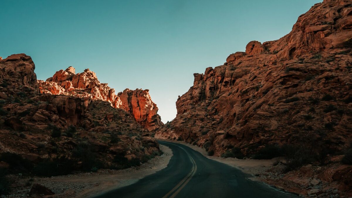
Potash Road, signed as Utah State Route 279, is a paved scenic byway that leaves U.S. 191 a few miles north of Moab and follows the Colorado River downstream for roughly 15 miles (24 km). Along the way you can see a roadside panel of Native American petroglyphs, dinosaur tracks in a sandstone slab, and the trailhead for Corona Arch, one of the most popular short hikes in the Moab area. The drive takes about 30 minutes each way without stops, and most visitors spend a half day on it.
The road is free, open year round and runs mostly through public land managed by the Bureau of Land Management, so no park pass or timed entry is required.
Where does Potash Road start and how long is it?
Potash Road starts at a signed junction on the west side of U.S. 191, just north of the Colorado River bridge and about 4 miles (6 km) north of downtown Moab, close to the turnoff for Arches National Park. From there the pavement runs along the north bank of the river under tall Wingate sandstone cliffs and ends at the Intrepid Potash plant, where potash is mined and dried in large, bright blue evaporation ponds. The total paved length is about 15 to 17 miles (24 to 27 km) depending on where you count from. Past the plant, the route becomes a rough dirt road that continues into the Island in the Sky district of Canyonlands; that section needs a high-clearance four-wheel-drive vehicle and current road information.
What can you see along Utah 279, mile by mile?
Distances below are approximate from the U.S. 191 junction. Watch for brown signs and roadside pullouts.
- Around miles 3 to 5 (5 to 8 km): the cliffs known as Wall Street rise right beside the pavement. Rock climbers use dozens of routes here, and you will often see them roped up a few feet from parked cars.
- Around mile 5 (8 km): a signed petroglyph panel, sometimes labeled “Indian Writing,” sits on the cliff above a small pullout. Figures of people and bighorn sheep are pecked into the dark desert varnish.
- Around mile 6 (10 km): the Poison Spider Mesa trailhead has an interpretive sign and a short, steep path up to a tilted rock slab with three-toed dinosaur tracks left by meat-eating dinosaurs.
- Around mile 10 (16 km): the Corona Arch trailhead, with a parking lot and vault toilet on the river side of the road.
- Around mile 13 to 14 (21 to 23 km): Jug Handle Arch, a narrow opening high on the cliff that you can see from the car.
- End of pavement: views of the potash ponds and the river bends below.
How do you find the petroglyphs on Potash Road?
Look for the roadside sign and pullout about 5 miles (8 km) in, then scan the base of the cliff and the rock face above it. The panels stretch along the wall, so walk the shoulder carefully and look up; binoculars help. The rock art is generally attributed to the Fremont and Ancestral Puebloan peoples who lived in the region before modern settlement. Touching, chalking or tracing the images damages them, and defacing rock art on federal land is illegal under federal law, so view and photograph only.
Where are the dinosaur tracks, and how hard is the walk?
The tracks are at the Poison Spider Mesa trailhead, around 6 miles (10 km) from the junction. A sign at the parking area points to the track slab, which sits up the slope behind it. The walk is short but steep and rocky, taking about 10 to 15 minutes round trip. The prints are easiest to see in low morning or late afternoon light, when shadows fill them. The same trailhead is a starting point for Jeep and mountain bike routes onto Poison Spider Mesa, so expect off-road traffic on busy weekends.
How long is the Corona Arch hike?
The Corona Arch trail is about 3 miles (4.8 km) round trip with a few hundred feet of elevation gain, and most people finish in 1.5 to 2.5 hours. The path crosses a railroad track, climbs gradually over slickrock marked with cairns, and then passes two short sections with steel cables and a short ladder bolted into the rock. Bowtie Arch, a pothole arch in the cliff, comes into view on the same trail before Corona Arch appears. Children who are comfortable on uneven ground usually manage the hike with an adult close by at the cable and ladder spots. There is no shade and no water on the trail, so start early in warm months and carry at least 1 to 2 quarts (1 to 2 liters) per person.
When is the best time to drive Potash Road?
Spring (March to May) and fall (September to November) bring the mildest weather for hiking to Corona Arch. Summer afternoons in Moab often pass 100°F (38°C), and the cliffs reflect heat onto the road, so plan the arch hike for early morning. Winter days are cool and quiet; ice can linger on shaded slickrock, and the cable section can be slick after snow. If you are visiting around the holidays, the guide to Utah national parks over Christmas break covers winter weather and road conditions in the area. Summer thunderstorms can send rockfall and flash floods across the road, so check the National Weather Service forecast before you go.
How does Potash Road fit into a Moab trip?
Potash Road works well as a half day before or after a visit to Arches National Park, since both turnoffs are a few minutes apart on U.S. 191. A common plan is the Corona Arch hike at sunrise, the dinosaur tracks and petroglyphs on the drive back, and Arches in the afternoon. It also slots into a longer route such as this 7-day Utah Mighty 5 road trip. Fuel up in Moab, since there are no services along the road; the road trip gas cost calculator estimates fuel for the full loop. For land rules, camping and permits along the river, the Bureau of Land Management Moab Field Office is the managing agency.
Quick answers
Do you need a pass or reservation for Potash Road?
No. Utah 279 is a state highway through mostly BLM land, with no entrance fee or timed entry. Fees apply only at some BLM campgrounds along the river.
Can you drive Potash Road in a regular car?
Yes, the paved section to the potash plant is fine for any passenger car. The dirt road beyond it toward Canyonlands needs high clearance and four-wheel drive.
Are dogs allowed on the Corona Arch trail?
Dogs are allowed on BLM land, but the ladder and cable sections are hard for most dogs, and the bare rock gets hot enough to burn paws in summer.
Is there camping along Potash Road?
The BLM runs several first-come, first-served campgrounds along the river on Utah 279. They fill quickly in spring and fall, so arrive early in the day.