Big Bend National Park Guide: Best Months, Chisos Basin, Santa Elena
Big Bend is best from October to April, when desert heat eases. See Chisos Basin and Santa Elena Canyon tips, plus how remote the park really is.
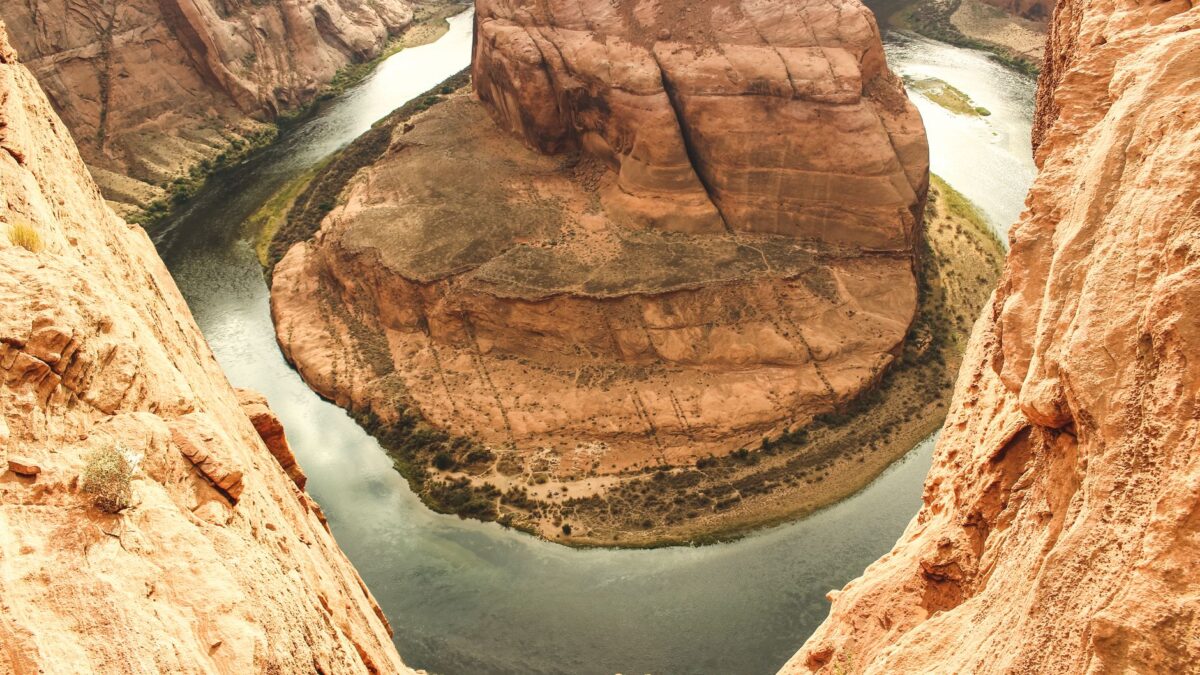
Big Bend National Park in West Texas is best visited from October through April, when daytime temperatures in the desert are mild and the Chisos Mountains are cool enough for long hikes. Summer brings desert highs that often pass 100°F (38°C) along the Rio Grande. The park covers more than 800,000 acres on the border with Mexico and sits hours from any major airport, so most visitors plan at least three days.
When is the best time to visit Big Bend?
October to April is the main season, with March and the weeks around Thanksgiving and New Year’s among the busiest periods. Spring break in March fills campgrounds and lodging early, and the desert often blooms in late winter and spring if rain has fallen.
- Fall (October and November): warm days, cooler nights, fewer crowds than spring.
- Winter (December to February): pleasant hiking weather in the desert, freezing nights in the mountains, and occasional snow or ice on Chisos Basin Road.
- Spring (March and April): the busiest stretch, with wildflowers and cactus bloom in good years.
- Summer (May to September): extreme heat at low elevations. July to September is also the monsoon season, with afternoon thunderstorms and flash floods.
In summer, plan desert walks for early morning and spend the hot hours in the Chisos Basin, which is usually 10 to 20 degrees cooler than the river corridor.
What is the Chisos Basin, and what can you do there?
The Chisos Basin is a high valley inside the Chisos Mountains, at roughly 5,400 feet (1,650 m), and it is the center of most hiking in Big Bend. The only lodge in the park, a campground, a store and a visitor center are located there, though lodge and facility status can change, so check the National Park Service page before booking.
Popular trails from the basin:
- Window Trail: about 5.6 miles (9 km) round trip, downhill to a pour-off framing the desert, then uphill on the way back.
- Lost Mine Trail: about 4.8 miles (7.7 km) round trip, with wide views over the mountains from the ridge.
- Emory Peak: the highest point in the park at 7,825 feet (2,385 m), a long day hike ending in a short rock scramble.
- Window View Trail: a short, paved loop that suits sunset and visitors with limited mobility.
Chisos Basin Road climbs with sharp curves and steep grades. The park advises against it for trailers over about 20 feet and RVs over about 24 feet. Black bears and mountain lions live in the Chisos, so store food in the provided lockers and keep children close on trails.
How do you get to Santa Elena Canyon?
Santa Elena Canyon is at the end of the Ross Maxwell Scenic Drive, about 30 miles (48 km) from the main road, in the southwest corner of the park. The Rio Grande has cut a gorge there with limestone walls up to about 1,500 feet (457 m) high, Texas on one side and Mexico on the other.
The Santa Elena Canyon Trail is about 1.7 miles (2.7 km) round trip. It starts by crossing Terlingua Creek, which can be dry, ankle deep or impassable after rain. Past the creek the path climbs a short set of switchbacks and follows the river into the canyon until the walls close in. Light is best in the afternoon, when the sun reaches the canyon mouth.
The scenic drive passes Sotol Vista, Mule Ears and Tuff Canyon, and a full trip with stops takes most of a day. A gravel route, Old Maverick Road, links the canyon to the west entrance; it can be rough or closed after storms.
How remote is Big Bend, really?
Big Bend is one of the most isolated national parks in the lower 48 states. Panther Junction, the park headquarters, is roughly 230 miles (370 km) from the Midland/Odessa airport and about 330 miles (530 km) from El Paso. The closest larger towns are Alpine, about 100 miles north, and Marathon, about 70 miles north.
What remoteness means in practice:
- Gas is sold inside the park at Panther Junction and Rio Grande Village, and outside it in the Study Butte and Terlingua area. Fill up whenever you can.
- Cell coverage is patchy or absent in much of the park. Download maps before arriving.
- Groceries in the park are limited to small camp stores. Bring most food and plenty of water.
- The nearest hospital is in Alpine, more than an hour and a half from most of the park.
- Highways leaving the park pass Border Patrol checkpoints, where drivers may be asked about citizenship.
The upside of the isolation is the night sky. Big Bend is an International Dark Sky Park, and on moonless nights the Milky Way is easy to see from almost any pullout.
How many days do you need in Big Bend?
Three days covers the main areas: one day for the Chisos Basin, one for the Ross Maxwell Scenic Drive and Santa Elena Canyon, and one for the Rio Grande Village side, with the hot springs and Boquillas Canyon. Driving between these areas takes time, since the park is large and speed limits are low. Five days or more leaves room for longer hikes, backcountry roads with a high-clearance vehicle, or a river trip.
Visitors with a passport can cross the Rio Grande into the Mexican village of Boquillas del Carmen through the official port of entry near Rio Grande Village, which keeps set days and hours. Questions about construction along the border come up often; recent coverage includes this site’s report on border barrier work around Big Bend National Park.
What should you know about fees and safety?
Big Bend charges an entrance fee per vehicle that is valid for seven days, and it accepts the America the Beautiful annual pass. If the trip is part of a longer national park road trip, the national park pass calculator shows whether an annual pass costs less than separate entry fees.
Desert safety rules matter more here than in most parks:
- Carry at least one gallon (about 4 liters) of water per person per day, more in heat.
- Do not hike low desert trails in summer afternoons.
- Stay out of washes and canyons when thunderstorms are nearby, since flash floods can arrive from storms miles away.
- Swimming in the Rio Grande is discouraged because of currents, sudden drop-offs and water quality.
Check the National Weather Service forecast for the park area before long hikes, and tell someone your route.
Quick answers
Is Big Bend worth the drive?
For visitors who want desert, mountains and a river canyon in one park with few crowds, yes. Plan at least three days so the drive pays off, and add the park to your national parks checklist once you go.
Can you stay inside Big Bend National Park?
Yes. The park has developed campgrounds at Chisos Basin, Rio Grande Village and Cottonwood, backcountry roadside campsites by permit, and the lodge in the Chisos Basin when it is open. Reservations are strongly recommended in the main season.
Do you need a four-wheel-drive vehicle?
No. All paved roads, including the routes to the Chisos Basin, Santa Elena Canyon and Rio Grande Village, suit a regular car. Many backcountry dirt roads need high clearance, and some need four-wheel drive.
Is Big Bend safe near the border?
Big Bend is a regularly visited national park with rangers and Border Patrol present. The more common risks for visitors are heat, dehydration, flash floods and long distances to medical care.