Natural Wonders of Utah Beyond the Mighty 5: 7 Places Worth the Drive
Seven Utah landscapes outside the national parks, with fees as of November 2026, how long each takes and how to fit them into a road trip.
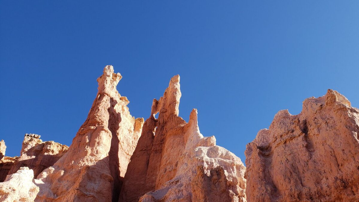
Utah’s best natural wonders outside the five national parks are Goblin Valley State Park, Little Wild Horse Canyon, Dead Horse Point State Park, the Bonneville Salt Flats and Coral Pink Sand Dunes State Park, plus Valley of the Gods and Goosenecks State Park near the Arizona line. Most take two to four hours, cost $0 to $20 per vehicle as of November 2026, and are best in spring and fall. Slot canyons such as Little Wild Horse need a dry forecast because of flash flood risk.
These places fill the gaps between Zion, Bryce Canyon, Capitol Reef, Arches and Canyonlands. If you are planning a 7-day Mighty 5 road trip, at least two of them sit within an hour of the usual route.
Which Utah natural wonders are worth adding to a trip?
The table compares the seven stops by location, manager, fee and the time most visitors spend. Fees are listed as of November 2026; Utah State Parks says it honors only the rates on its own website, so check the park page before you go.
| Place | Area | Managed by | Day-use fee (Nov 2026) | Best months | Time needed |
|---|---|---|---|---|---|
| Goblin Valley State Park | Between Green River and Hanksville | Utah State Parks | $20 per private vehicle | March–May, September–October | 2–4 hours |
| Little Wild Horse Canyon | San Rafael Swell, a few miles from Goblin Valley | Bureau of Land Management (BLM) | No park entry fee (public land) | March–May, September–October | 2–5 hours |
| Dead Horse Point State Park | About 32 miles from Moab | Utah State Parks | About $20 per vehicle (confirm online) | March–May, September–November | 2–3 hours |
| Bonneville Salt Flats | I-80 Exit 4 near Wendover, 120 miles west of Salt Lake City | BLM | No fee outside permitted events | Late summer and fall, when the salt is dry | 1–2 hours |
| Coral Pink Sand Dunes State Park | West of Kanab | Utah State Parks | $15 per vehicle | April–June, September–October | 2–3 hours |
| Valley of the Gods | Near Mexican Hat and Bluff | BLM | No fee | October–May | 1–2 hours |
| Goosenecks State Park | Near Mexican Hat | Utah State Parks | Small per-vehicle fee | Year-round | 30–60 minutes |
What is there to do at Goblin Valley State Park?
Goblin Valley is a basin of thousands of mushroom-shaped sandstone hoodoos that you can walk among freely, without a set trail. Kids treat it as a giant playground, and adults usually spend more time here than they planned. The day-use fee is $20 per private vehicle as of November 2026, and Utah State Parks says the pass is valid until 10 p.m. the day after purchase.
The park also has a campground and yurts, which are popular because the park is a certified International Dark Sky Park. Summer afternoons are hot and the hoodoo area has no shade, so go early or late in the day from June to August.
How hard is the Little Wild Horse Canyon hike?
Little Wild Horse Canyon is one of the most accessible slot canyons in Utah, with narrow sections that are often only shoulder-wide. The trailhead is on BLM land a few miles past the Goblin Valley turnoff. Many hikers walk into the narrows and back, which takes two to three hours with no technical climbing in normal conditions.
A longer loop links Little Wild Horse with neighboring Bell Canyon by way of a dirt road, for a total of about 8 miles. Expect some scrambling over chockstones and occasional pools after rain. Do not enter the canyon if storms are forecast anywhere in the area; the safety section below explains why.
Is Dead Horse Point worth it if you are visiting Canyonlands?
Yes. Dead Horse Point State Park sits on the same road as Canyonlands’ Island in the Sky district, and its main overlook looks down about 2,000 feet to a tight gooseneck of the Colorado River. The view is one of the most photographed in Utah, especially at sunrise. Guides list the vehicle fee at about $20; the state park page did not display its fee table when checked in November 2026, so confirm it before you go.
Federal passes such as America the Beautiful do not cover Utah state parks. If you are comparing the two nearby national parks, our Arches vs Canyonlands comparison covers how much time each needs. Dead Horse Point is also a certified dark sky park, and its rim trails are short and mostly level.
When can you drive on the Bonneville Salt Flats?
The Bonneville Salt Flats are a white salt crust about 12 miles long and 5 miles wide, covering roughly 30,000 acres of BLM land west of Salt Lake City. The BLM says motor vehicle use is limited by a seasonal closure in spring, when the salt is moist or covered by standing water. Closure dates vary and are posted by sign.
Land speed racing has used the flats since 1914. In 2026, permitted events such as Speed Week (July 27–August 8) and World of Speed temporarily closed the salt to general access, although the BLM said visitors could still go up to 100 feet onto the salt from the portal sign without paying an event entrance fee. Check the BLM Bonneville Salt Flats page for the current event calendar.
- Never drive onto wet or dark, soft-looking salt. Vehicles sink and damage the crust.
- Bring sunglasses. The glare off the salt is intense even in winter.
- Sunset is the most popular time, when the flats reflect the sky after light rain.
What makes Coral Pink Sand Dunes different?
Coral Pink Sand Dunes State Park is a field of orange-pink dunes formed from eroded Navajo Sandstone, at about 6,000 feet near Kanab. Wind funnels through a notch between two mountain ranges and drops the sand here. Day use costs $15 per vehicle as of November 2026.
Much of the dune field is open to off-highway vehicles, so walkers should stay aware of traffic. A fenced conservation area protects the Coral Pink Sand Dunes tiger beetle, a beetle found nowhere else. The sand gets very hot by midday in summer; morning and evening are best for walking and sandboarding.
Which scenic stops are near Monument Valley on the Utah side?
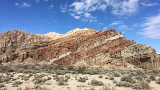
Valley of the Gods is a free BLM area with a 17-mile dirt road through red buttes and spires, similar in feel to Monument Valley but with far fewer people. In dry weather many passenger cars manage it slowly; after rain the clay turns slick and the washes can flood. Free dispersed camping is allowed on BLM land here, subject to posted rules.
Goosenecks State Park, a short drive away, overlooks the San Juan River as it winds through deep, tight meanders. It is a quick stop with a small fee and primitive campsites on the rim. Both pair well with a drive to the Wave and Coyote Buttes area farther west, if you have permits.
How do you stay safe from flash floods in Utah’s slot canyons?
Flash floods are the main hazard in Utah’s narrow canyons, and they can arrive under a blue sky when rain falls miles upstream. The National Weather Service advises checking the forecast before you go and never entering a flooded road or canyon. Its flood safety page explains the warning types.
- Check the National Weather Service forecast for the area, not only for your town, on the morning of the hike.
- Skip slot canyons when thunderstorms are forecast, especially during the July–September monsoon season.
- Know your exits. Note places where you could climb to high ground as you walk in.
- Turn back if the water turns muddy, rises, or carries sticks and debris, or if you hear a roar upstream.
- Never drive across a flooded wash. Turn around and wait; most desert floods drop within hours.
Heat is the second risk. Carry at least a gallon of water per person per day in summer, wear a hat, and plan hikes for early morning. Many of these places have no cell coverage, so tell someone your route and download offline maps.
How can you fit these places into a road trip?
Group the stops by region so you are not backtracking across the state:
- Central Utah (1 day): Goblin Valley and Little Wild Horse Canyon together, between Capitol Reef and Moab.
- Moab (half day): Dead Horse Point at sunrise, then Canyonlands’ Island in the Sky.
- Southern Utah (half day): Coral Pink Sand Dunes on the way between Zion and Kanab.
- Southeast corner (half day): Valley of the Gods and Goosenecks on the way to or from Monument Valley.
- Northwest (2–3 hours): Bonneville Salt Flats as a detour on I-80 between Salt Lake City and Nevada.
Goblin Valley and Dead Horse Point are also good bases for night skies; see our list of dark sky places for stargazing for timing around the new moon.
Bottom line
If you add only one place, make it Goblin Valley with a walk into Little Wild Horse Canyon on a dry day. Dead Horse Point is the easiest add-on for anyone already in Moab, and Coral Pink Sand Dunes fits neatly between Zion and Kanab. Check state park fees online, keep slot canyon plans flexible around the weather, and visit in spring or fall for the most comfortable temperatures.
FAQ
Does the America the Beautiful pass cover Utah state parks?
No. The America the Beautiful pass covers federal sites such as national parks and some BLM fee areas. Utah state parks charge their own day-use fees, and Utah sells a separate annual state park pass.
Can you visit Goblin Valley and Little Wild Horse Canyon in one day?
Yes. The trailhead is a few miles from the Goblin Valley entrance, so many visitors hike the canyon in the morning and explore the hoodoos in the late afternoon light. Skip the canyon if storms are forecast.
When are the Bonneville Salt Flats under water?
The salt is usually wet in winter and spring, and the BLM limits vehicle use when it is moist or flooded. Late summer and early fall are typically driest, but that is also racing season, when permitted events close parts of the flats.
Is Valley of the Gods OK for a regular car?
In dry conditions many drivers take regular cars slowly along the 17-mile dirt road. After rain the road can become impassable, so check conditions locally and do not attempt it during storms.