California Road Trip in 7 Days: San Francisco, Yosemite and Big Sur
One week, one rental car and three very different Californias: the city, the Sierra Nevada and the Big Sur coast. Here is the day-by-day plan, with the road and reservation details that change by season.
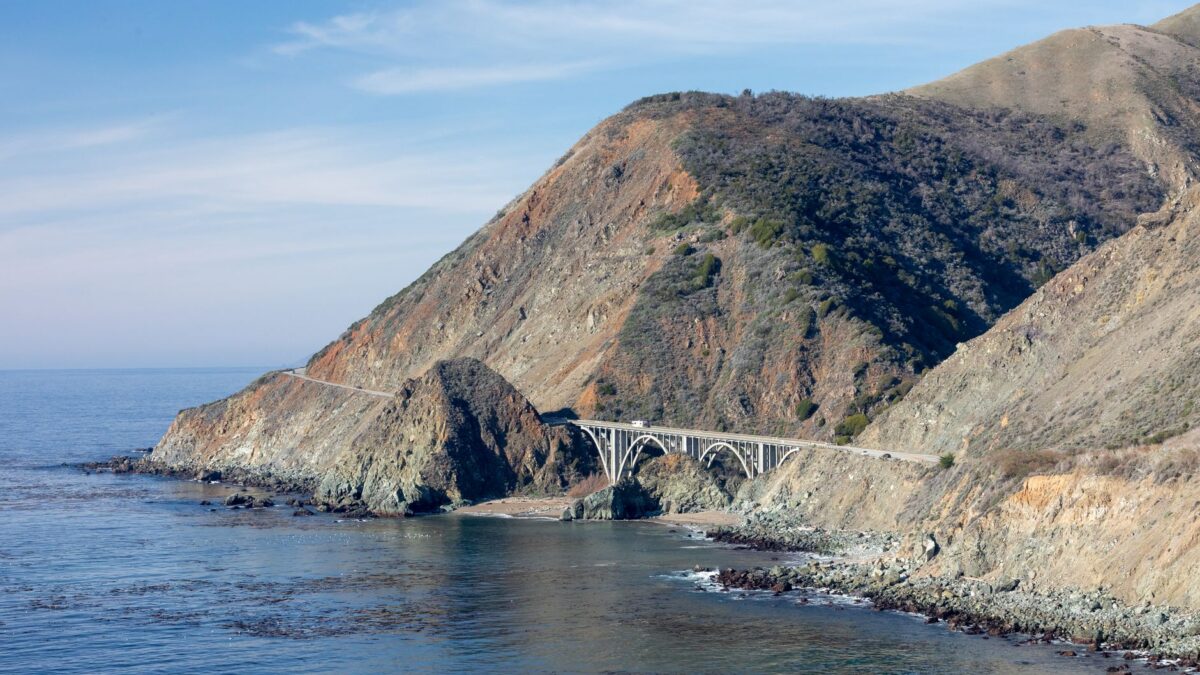
A 7-day California road trip works best as a one-way drive: San Francisco, two nights in Yosemite, Monterey and Carmel, the Big Sur coast on Highway 1, then Los Angeles. It covers about 750 miles. As of November 2026, Yosemite needs no entry reservation, and Highway 1 through Big Sur is open again after the Regent’s Slide repair.
The plan below is built for late spring to fall. It includes an optional swap that adds Sequoia National Park and its giant trees in place of a Monterey day.
What does the 7-day route look like?
The route goes east from San Francisco into the Sierra Nevada, back west to the coast at Monterey, and south along Highway 1 to Los Angeles. Most driving days are 3 to 4.5 hours before stops.
| Leg | Distance | Drive time (no stops) |
|---|---|---|
| San Francisco to Yosemite Valley | about 190 miles | 4–4.5 hours |
| Yosemite Valley to Mariposa Grove | about 36 miles | 1–1.25 hours |
| Mariposa Grove to Monterey | about 185 miles | 3.5–4 hours |
| Monterey to Cambria via Big Sur | about 110 miles | 3 hours (two-lane, curvy) |
| Cambria to Los Angeles | about 230 miles | 4–5 hours with city traffic |
| Sequoia option: Mariposa Grove to Giant Forest | about 145 miles | 3–3.5 hours |
| Sequoia option: Giant Forest to Monterey | about 210 miles | 4–4.5 hours |
What should you do each day?
Day 1: San Francisco
Walk or drive across the Golden Gate Bridge, explore the Presidio and Crissy Field, and end at the waterfront. If you want to see Alcatraz, book the official ferry weeks ahead. Pick up the rental car on the morning of Day 2 to avoid city parking costs. Base: San Francisco.
Day 2: Drive to Yosemite (about 190 miles)
Leave early. Enter on Highway 120 (Big Oak Flat) or Highway 140 (Arch Rock). Your first stops in Yosemite Valley are Tunnel View, Bridalveil Fall and the short loop to Lower Yosemite Fall. Base: Yosemite Valley lodging, or a gateway town such as Groveland, El Portal, Mariposa or Oakhurst.
Day 3: Yosemite Valley and Glacier Point
Start early on the Mist Trail toward Vernal Fall, a steep and often wet climb on granite steps. After lunch, drive up to Glacier Point (about an hour each way from the Valley) for the view over Half Dome, and stay for sunset. The Glacier Point Road is usually open from about May to November. Base: same as Day 2.
Day 4: Mariposa Grove to Monterey (about 220 miles)
Walk among the giant sequoias of Mariposa Grove near the South Entrance, then drive west through the Central Valley to Monterey. Spend the evening on Cannery Row. Base: Monterey or Pacific Grove.
Day 5: Monterey and Carmel
Visit the Monterey Bay Aquarium, drive the 17-Mile Drive (a private toll road), and walk around Carmel-by-the-Sea. Point Lobos State Natural Reserve, just south of Carmel, has short coastal trails and sea otters. Base: Monterey or Carmel.
Day 6: Big Sur to Cambria (about 110 miles)
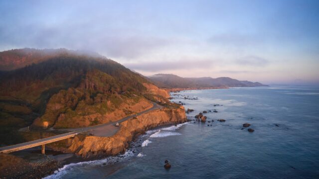
This is the slow, scenic day. Stop at Bixby Creek Bridge, Pfeiffer Big Sur State Park and the McWay Falls overlook in Julia Pfeiffer Burns State Park. South of Ragged Point, pull in at the elephant seal viewing area near Piedras Blancas. Fill the tank in Carmel: gas in Big Sur is limited and expensive, and cell coverage is patchy. Base: Cambria or San Simeon.
Day 7: Hearst Castle, Santa Barbara and Los Angeles (about 230 miles)
Take a morning tour of Hearst Castle (book through the official California State Parks site), then drive via Morro Bay and San Luis Obispo to Santa Barbara for lunch. Finish in Los Angeles via Malibu if traffic allows.
Sequoia swap
To see Sequoia National Park, replace Days 4 and 5: drive from Mariposa Grove to Sequoia on Day 4 and see the General Sherman Tree and Moro Rock, then drive to Monterey or Carmel on Day 5. You lose the slow Monterey day but gain the largest trees on Earth by volume. The park advises against vehicles longer than 22 feet on the steep, winding section of the Generals Highway below Giant Forest.
Which reservations and road closures affect this trip?
Yosemite entry
Yosemite National Park announced in February 2026 that it would not use a timed reservation system in 2026, after reviewing traffic and parking data from 2025. In 2025, reservations were required on peak summer days. Rules for 2027 had not been announced as of November 2026, so check the park’s entrance reservations page before booking.
The entrance fee is $35 per private vehicle for 7 days at both Yosemite and Sequoia & Kings Canyon, as of November 2026. Both parks are among the 11 that charge non-US residents age 16 and older an extra $100 per person, unless the group enters with an annual or America the Beautiful pass. Our guide to the America the Beautiful pass shows when the pass pays off.
Tioga Road and Glacier Point Road
Tioga Road (Highway 120 east through Tuolumne Meadows) is typically open from late May or June until sometime in November; in 2026 it opened on May 15. It is not needed for this route, but it is the only road across the park to the Eastern Sierra. From about November to March, carry tire chains in Yosemite, because chain controls are common.
Highway 1 through Big Sur
Caltrans reopened Highway 1 at Regent’s Slide on January 14, 2026, restoring the full coastal link between Carmel and Cambria for the first time in nearly three years. Short full closures can still happen after storms while crews clear debris. Check Caltrans QuickMap the night before and the morning of Day 6.
Where should you stay and what should you book ahead?
- Yosemite lodging: rooms in the Valley open for booking many months ahead and sell out for summer. If you miss them, gateway towns are 30 to 75 minutes from the Valley.
- Big Sur and Cambria: Big Sur has few rooms and high prices. Cambria and San Simeon have more choice.
- Hearst Castle tour: book a few weeks ahead for summer and holiday dates.
- Alcatraz ferry: book several weeks ahead in summer.
- Rental car: a one-way rental from San Francisco to Los Angeles is common, but check the drop fee before you commit.
When is the best time for this road trip?
September and October are the best months overall, with warm coastal weather, fewer crowds and all Yosemite roads open. Late May and June are best for waterfalls.
| Season | Yosemite | Coast |
|---|---|---|
| April–June | Waterfalls near their peak; high roads may still be closed early in the season | Green hills, wildflowers; morning fog common from May |
| July–August | Busiest; hot in the Valley; some waterfalls shrink | Frequent fog in Monterey and Big Sur; peak hotel prices |
| September–October | Fewer crowds; Yosemite Falls may be dry | Clearest, warmest coastal weather |
| November–March | Tioga and Glacier Point roads closed for the season; chains may be required | Storms can close Highway 1; whale migration season |
How much does a 7-day California road trip cost?
For two people sharing a room and a car, plan on roughly $2,300–$3,000 on a budget, $3,800–$5,000 mid-range and $6,500 or more for comfort, excluding flights. These are planning estimates as of November 2026.
| Item | Budget | Mid-range | Comfort |
|---|---|---|---|
| Lodging per night | $130–$200 (motels in gateway towns) | $220–$350 (hotels, inns) | $400–$700 (in-park lodges, Carmel and Big Sur inns) |
| Car per day | $50–$80 | $70–$110 | $100–$150 |
| Fuel for about 750 miles | $150–$200 | $150–$200 | $170–$230 |
| Food per person per day | $45–$65 | $80–$120 | $150 or more |
| Park fees and attractions | $100–$150 | $250–$350 | $400–$600 |
| Rough total for two | $2,300–$3,000 | $3,800–$5,000 | $6,500 or more |
What if you have less or more time?
- 5 days: drop Glacier Point and one coast night, or skip Yosemite and follow our Pacific Coast Highway itinerary instead.
- 9–10 days: add the Sequoia swap without losing Monterey, and give Yosemite a third day. Our 3-day Yosemite itinerary covers Tuolumne Meadows and longer hikes.
Safety note: Yosemite’s rivers are cold and fast, especially in spring. Stay behind railings near waterfalls, never wade above a fall, and read the park’s safety page before hiking.
Bottom line
Seven days is enough to see San Francisco, Yosemite Valley, Monterey, Big Sur and Los Angeles at a steady pace. Book Yosemite lodging first, plan the Big Sur day around daylight and road conditions, and choose the Sequoia swap only if giant trees matter more to you than a slow day in Monterey.
FAQ
Do you need a reservation to enter Yosemite in 2026?
No. Yosemite did not use a timed reservation system in 2026. You still pay the entrance fee, and lodging and campgrounds still need bookings.
Is Highway 1 through Big Sur open?
Yes, as of November 2026. The Regent’s Slide section reopened in January 2026, but storms can cause short closures, so check Caltrans QuickMap before you drive.
Can you add Sequoia to a 7-day trip?
Yes, by replacing the Monterey day. It adds about 4 hours of driving to the route but lets you see the General Sherman Tree.
Which direction should you drive Highway 1?
Southbound is usually easier, because the ocean-side turnouts are on your side of the road.