Page, Arizona on a Budget: 9 Free and Low-Cost Stops
Page, Arizona on a budget means Horseshoe Bend, Glen Canyon Dam overlooks and free rim trails. Costs, timing and money-saving tips beyond Antelope Canyon.
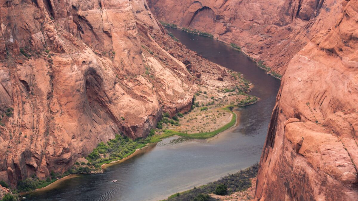
Page, Arizona has several free or low-cost stops beyond the paid Antelope Canyon tours. The best known are Horseshoe Bend (a short hike with a city parking fee), the free Glen Canyon Dam overlook and visitor center, the Hanging Garden Trail and the Page Rim View Trail. With a national parks pass, Lake Powell’s beaches and viewpoints in Glen Canyon National Recreation Area add little or nothing to the cost of a trip.
Antelope Canyon is on Navajo land and can only be visited with a licensed Navajo guide, so it is usually the largest single expense in Page. If you are deciding which slot canyon to book, our comparison of Upper, Lower and Canyon X tours covers the differences. Everything below can fill the rest of your time for very little money.
What are the best free things to do in Page, Arizona?
The best free stops in Page are the Glen Canyon Dam viewpoints, the Hanging Garden Trail, the Page Rim View Trail and the overlook above Wahweap Bay.
- Glen Canyon Dam Overlook. A short walk from a parking lot on Scenic View Drive leads to a rim viewpoint looking down on the dam and the Colorado River. It is free and takes 20 to 30 minutes.
- Carl Hayden Visitor Center. Next to the dam on US 89, this visitor center has exhibits on the dam’s construction and on Lake Powell, and the windows look straight across at the dam. Entry to the center is free; guided dam tours, when offered, cost extra and require a security screening.
- Glen Canyon Dam Bridge. The pedestrian walkway on the US 89 bridge beside the dam gives a view of the river several hundred feet below. Park at the visitor center and walk over.
- Hanging Garden Trail. This easy trail of about 1 mile (1.6 km) round trip starts off US 89 just east of the dam and ends at a seep spring where ferns and other plants grow out of the sandstone wall.
- Page Rim View Trail. A loop of roughly 10 miles (16 km) circles the mesa that Page sits on, with views of Lake Powell and the surrounding desert. You can walk any short section from one of several trailheads in town instead of the full loop.
- Wahweap Overlook. A short paved spur off the road toward Wahweap Marina climbs to a viewpoint over Wahweap Bay and Lake Powell. It is a popular sunset spot.
How much does Horseshoe Bend cost?
Horseshoe Bend has no entrance fee for hikers, but the City of Page charges a parking fee per vehicle at the trailhead lot off US 89, with separate rates for motorcycles and larger vehicles. The paved trail is about 1.5 miles (2.4 km) round trip to the rim overlook, where the Colorado River makes its tight bend about 1,000 feet (300 m) below.
The trail has almost no shade. In summer, temperatures in Page often pass 100°F (38°C), so carry water and go early in the morning or late in the afternoon. The rim has a railing at the main viewpoint only; stay well back from unfenced edges.
Is Lake Powell free to visit?
Most of the Lake Powell shoreline near Page is inside Glen Canyon National Recreation Area, which charges an entrance fee per vehicle at its fee stations. An America the Beautiful annual pass covers that fee, and it also covers Grand Canyon, Zion, Bryce Canyon and other federal sites, so it often pays for itself on a longer Southwest road trip.
Inside the recreation area, low-cost options include:
- Lone Rock Beach, just over the Utah state line, where you can drive onto the sand, swim and camp for a per-night fee on top of the entrance fee.
- Swimming and picnic areas near Wahweap Marina.
- Free ranger programs at the visitor centers in season.
Boat rentals and lake cruises are the expensive part of a Lake Powell visit. Skipping them keeps the day cheap.
Which free stops are worth a short drive from Page?
Two free stops within about an hour of Page are worth the gas: Navajo Bridge to the south and the Toadstools hoodoos to the west.
- Navajo Bridge. On US 89A at Marble Canyon, a historic steel bridge now open only to pedestrians spans Marble Canyon next to the newer highway bridge. A small interpretive center sits at the west end, and California condors are sometimes seen perched on the bridge.
- The Toadstools. In Grand Staircase-Escalante National Monument in Utah, an easy trail of under 2 miles (3.2 km) round trip off US 89 leads to balanced rock formations. There is no fee, and the trail is exposed, so bring water.
To estimate fuel for side trips like these, the road trip gas cost calculator works out the cost from your distance and your car’s mileage.
How can you save money on a trip to Page?
The biggest savings in Page come from timing and from where you sleep and eat.
- Visit outside summer. Hotel rates in Page are usually highest from late spring to early fall, and winter is the cheapest season.
- Book Antelope Canyon early and compare tour times. Midday slots in Upper Antelope Canyon are the most popular and often the priciest; other slots and other canyons can cost less.
- Camp or stay outside the high season. Lone Rock Beach and campgrounds in Glen Canyon National Recreation Area cost less than most motels.
- Buy groceries in town. Page has supermarkets, and packing lunches for Horseshoe Bend and the lake saves more than any single attraction.
- Fill the tank in Page before heading out. Gas stations are few between Page and the Grand Canyon or Kanab.
What time zone is Page in?
Page is on Arizona time, which does not change for daylight saving time, while the Navajo Nation, including Antelope Canyon, does change. From spring to fall, the canyon is one hour ahead of the city of Page. Tour companies state times in Navajo time or Arizona time, so check which one your booking uses. Lone Rock Beach and the Toadstools are in Utah, which also uses daylight saving time.
Where does Page fit on a bigger trip?
Page is about two and a half hours from the Grand Canyon’s South Rim and sits between the Grand Canyon and the Utah parks, so many people stop for one or two nights on a loop. Our 7-day Grand Canyon, Zion and Bryce itinerary from Las Vegas shows how a Page stop fits into that route.
Quick answers
How many days do you need in Page, Arizona?
One full day covers Antelope Canyon, Horseshoe Bend and the dam viewpoints. A second day adds Lake Powell, a longer section of the Rim View Trail or a drive to Navajo Bridge or the Toadstools.
Can you see Antelope Canyon for free?
No. All Antelope Canyon visits require a paid tour with a licensed Navajo guide. The free stops in Page are the dam viewpoints, the town’s trails and the Wahweap Overlook.
Is the national parks pass worth it for Page?
It is if you also visit the Grand Canyon or the Utah parks on the same trip, because one annual pass covers Glen Canyon National Recreation Area and those parks. It does not cover Horseshoe Bend parking or Antelope Canyon tours.
When is Horseshoe Bend least crowded?
Early morning is usually quieter than sunset, which draws the biggest crowds of the day.